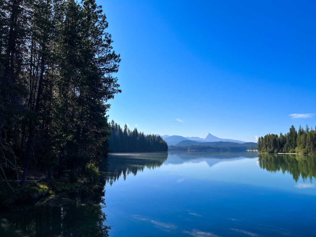
Rally 2025 Day 4 / Lemolo Lake
Geology Rocks! by Ian Madin
Ian Madin worked as a geologist with the Oregon Department of Geology and Mineral Industries for 32 years and has ridden with Cycle Oregon for over a decade now. Here, he gives us a look at the cool and sometimes hidden geology of the regions through which we ride. Look for him out on the route and back in camp at Rally ’25.
Glacial Cirques & Canyon-Filling Flows
The route on Day 4 continues with the earlier themes of Cascade volcanic eruptions, glaciers and earthquake faults and the effect they have on the landscape. Leaving camp the route goes along the shore of Diamond Lake then across the floor of the broad glacial valley that holds the lake. After crossing Thielsen Creek, the route climbs onto a broad flat surface covered with Mazama ash flow.

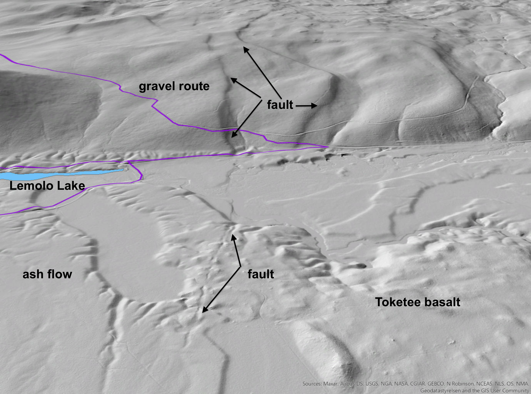
Coming up the Rogue on Day two, the valley floor was flat because the ash flow had filled it completely. Here the ash flow is a thin layer on top of an older lava flow that filled the canyon 750,000 years ago. This is called the Toketee Basalt, named for the famous Toketee Falls, which erupted from vents east of Lemolo Lake and flowed 30 miles down the canyon of the North Fork of the Umpqua, filling it to a depth of 300-400 feet, and leaving a broad barren lava plain in place of a glacier carved valley.
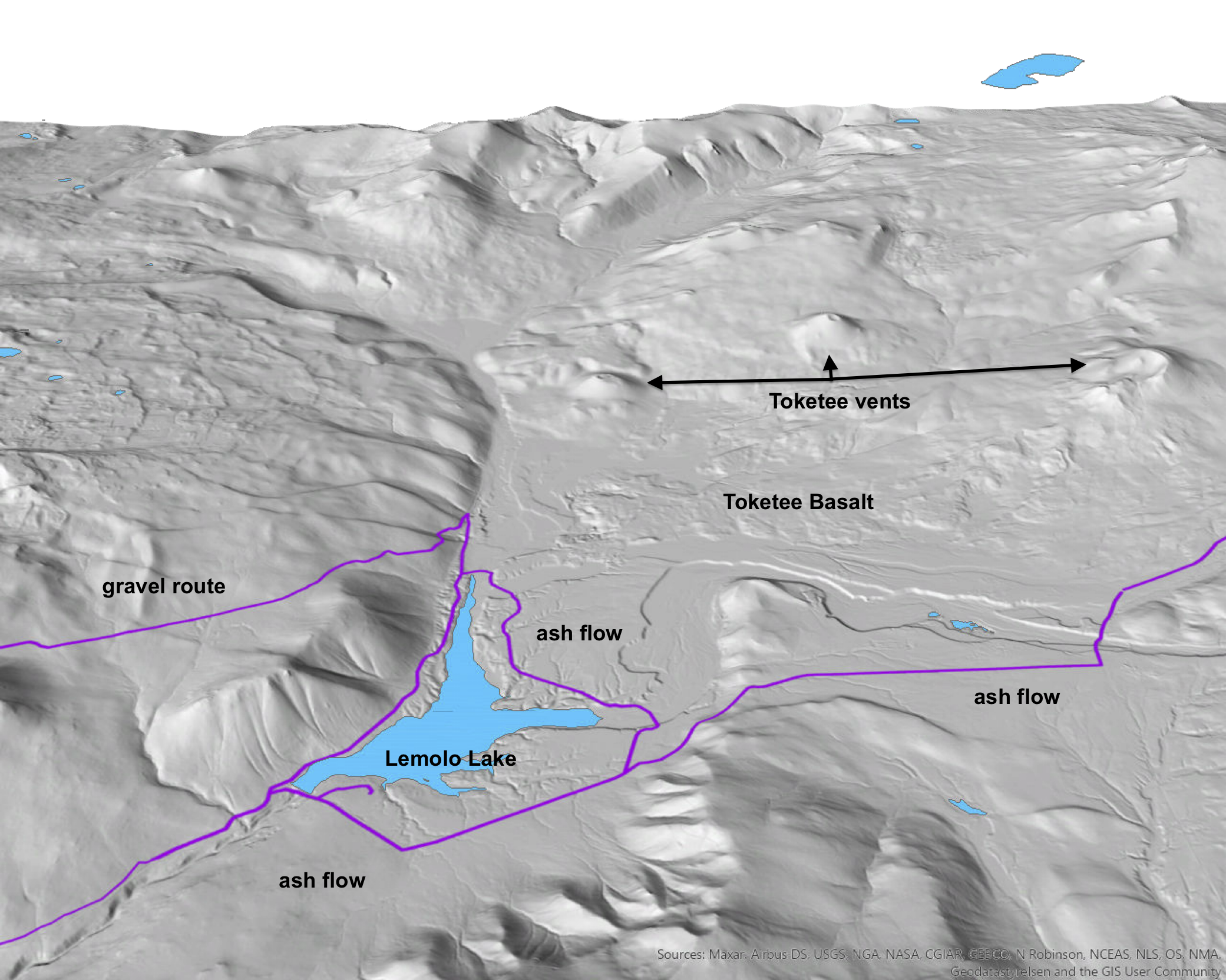
years ago, filling the canyon of the North Umpqua River. Route in purple.
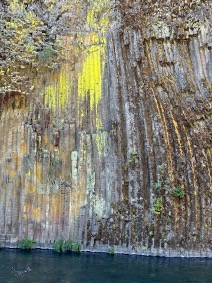
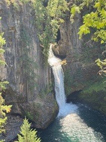
After the lava cooled, the river began to re-establish its course, flowing across the top of the canyon-filling lava until it cascaded down the steep front of the flow. The power of the water cascading down a 300-foot-high falls allowed the river to rapidly carve a new canyon through the lava, leaving the original lava surface high on the new canyon walls. In places, the river is still carving through the basalt, leaving beautiful waterfalls like Toketee Falls and cliffs shaped into fantastic columns as the lava cooled and shrank.
When Mt. Mazama erupted the canyon was once again filled, this time with ash flow that travelled 20 miles down the canyon, filling it with 50 to 100 feet of ash and pumice. In the thousands of years since the eruption, the river has quickly carved through the ash flow, re-establishing its course.
Those who go on the long gravel route will start by switchbacking up the hill after leaving the flat ash flow plain around Lemolo Lake. The switchbacks cross a pair of active faults at Mile 18.7, that make short sharp cliffs, or scarps across the landslide. These scarps were formed during several earthquakes over the past thousands of years, growing a few feet in seconds during each earthquake.
Past the Faults, the gravel route climbs a high ridge forming the headwaters of the North Umpqua. At a bit over 6,000 feet, this ridge was high enough for small glaciers to form during the peak of the last ice age, 18,000 years ago. Ice and snow accumulated on the shaded North and East slopes of the ridge, and when the ice became thick enough it started to flow. Over time the flowing ice gouged a bowl-shaped depression out of the ridge, called a cirque. When the ice melted away 11,000 years ago, small glacial lakes remained in the cirques, filling holes carved into bedrock by the moving ice.
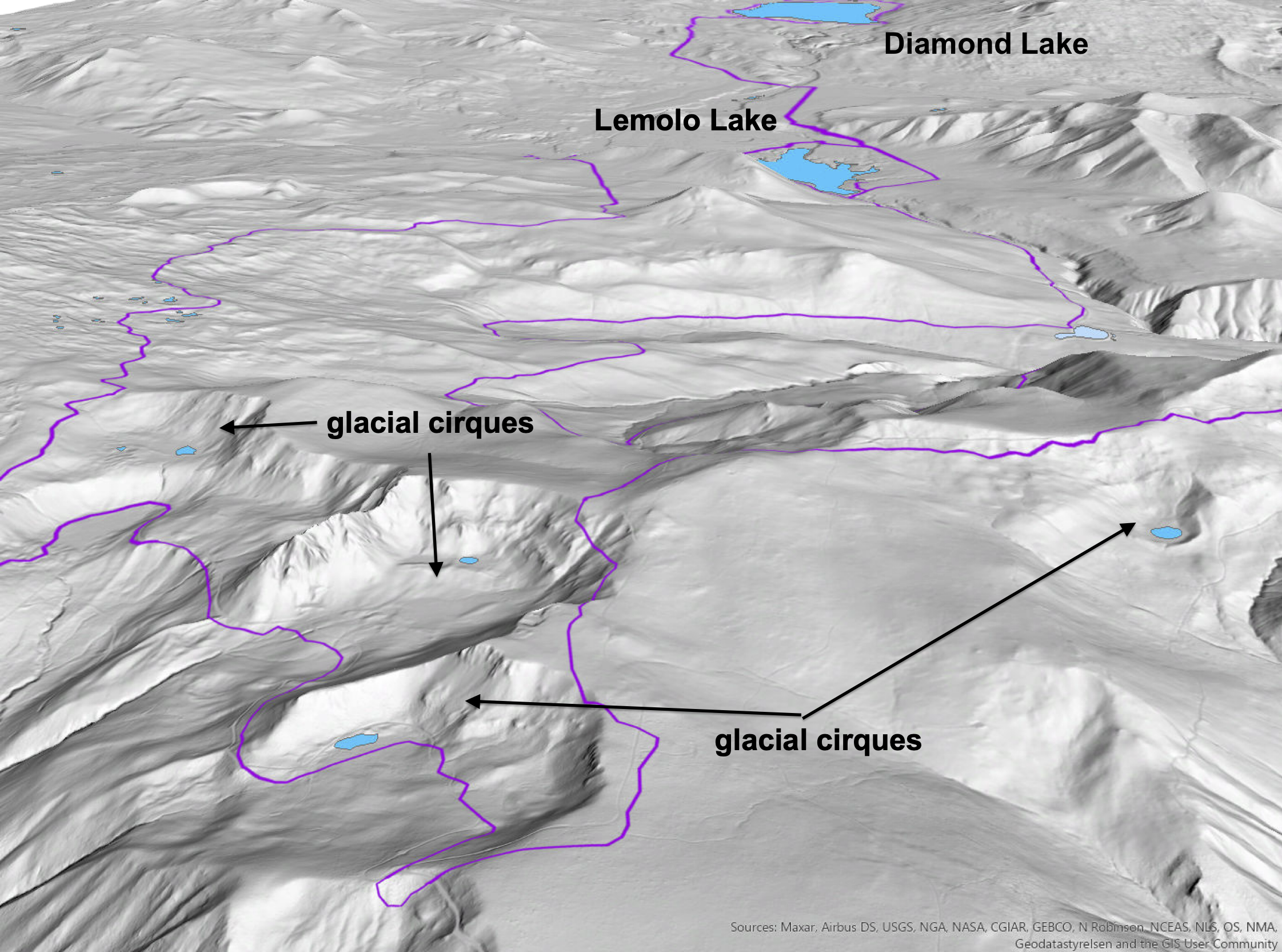
holding a small lake. Route in purple.
About Lemolo Lake
Lemolo (pronounced Lem-O-Low) is derived from a Chinook Nation word meaning “wild” or “untamed”. Lemolo Lake is a small natural lake and reservoir in Douglas County, Oregon formed by the construction of two hydroelectric dams, Lemolo #1 (1955) and Lemolo #2 Forebay (1956)
Quite possibly the world’s only dinosaur-shaped lake. Rawwrrr!
Wildstones
Off the bike, Ian applies his interest in Oregon geology through art and sculpture. Check out his work at Wildstones.art and follow him on Instagramto see what he’s up to in the studio, out in the field or in the saddle. Rock on, Ian!
For a downloadable PDF of Ian’s full report, click here.