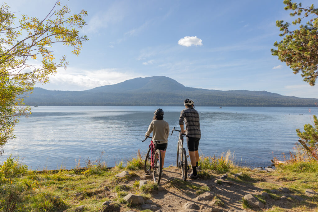
Rally 2025 Day 2 / Prospect – Diamond Lake
Geology Rocks! by Ian Madin
Ian Madin worked as a geologist with the Oregon Department of Geology and Mineral Industries for 32 years and has ridden with Cycle Oregon for over a decade now. Here, he gives us a look at the cool and sometimes hidden geology of the regions through which we ride. Look for him out on the route and back in camp at Rally ’25.
Ash Flows, Ice Flows & Earthquakes
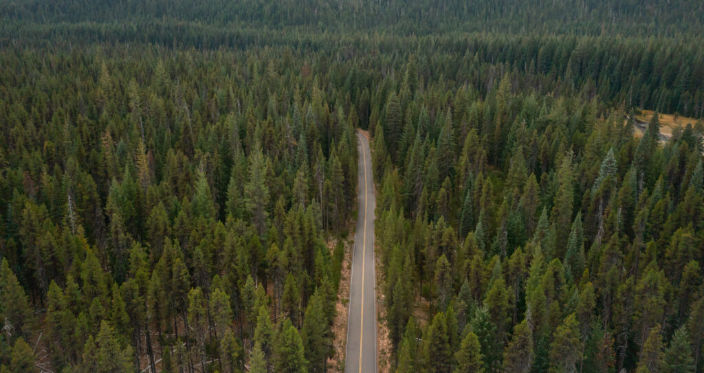
The Day two route takes you up the Rogue River valley to its headwaters. There is not much to see along the route in the way of rocks, and the forest obscures much of the landscape, but you will be riding through geologic features with dramatic origins. The floor of the valley is very flat, because it was filled with the same ash flows from Mt. Mazama that you saw on Day 1.
Four large valleys channeled the ash flowing down the west side of the erupting mountain into the Rogue valley, filling it with a thick layer of hot ash which compacted into a rock called tuff, leaving a smooth flat surface. Since the eruption, the Rogue and its tributaries have cut narrow gullies through the soft tuff. After the snack stop at Farewell Bend, the route leaves the Rogue River to climb up on top of the ash flow surface for 8.5 miles, the swiftly descends from the top of the ash flow back to river level, with big roadcuts exposing the white ash and pumice. The ash flow is at least 220 feet thick here. You’ll see a good example of this at Mile 18.2.
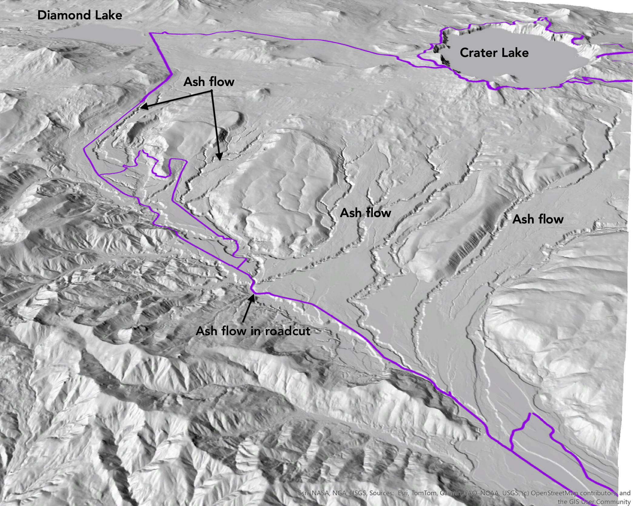
hundreds of feet of ash flow from the Mt. Mazama eruption. Cycling routes in purple.
From this point on, the valley was carved by rivers of ice that originated on Mt. Mazama before its eruption. When the last great ice age peaked about 18,000 years ago, the upper Rogue valley was filled with a glacier 1,300 feet thick. An ice cap covered the High Cascades, sending tongues of flowing ice down all of the canyons around its edge. Those rivers of ice scoured the bedrock, scraping off all of the loose rock, which was then carried with the ice. At the edges and ends of the glacier, the ice melted away, and the rock it was carrying piled up in long thin ridges called lateral moraines. Although not visible from the road, there are many beautifully preserved moraines in the upper part of the valley.
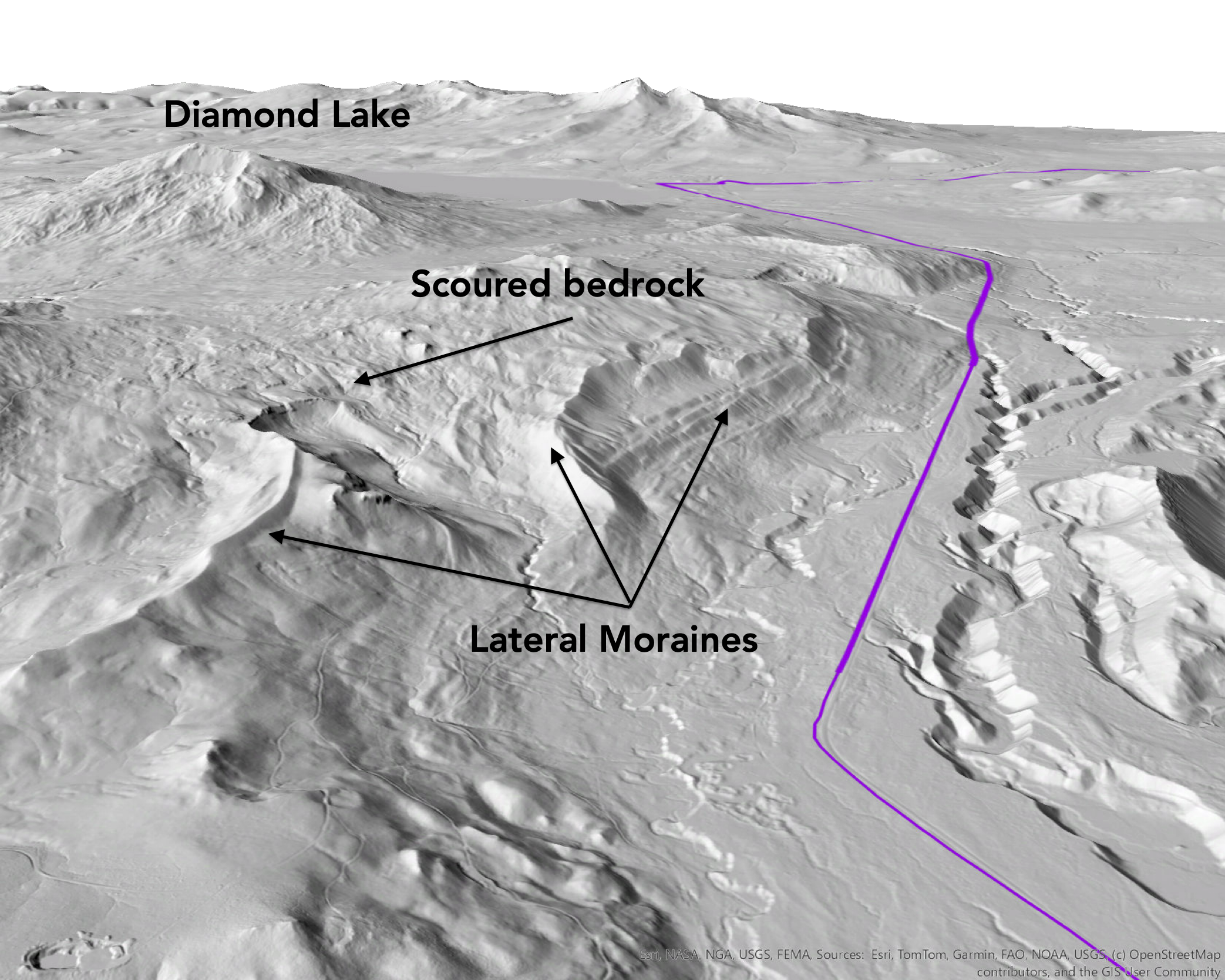
Long thin ridges of rock called lateral moraines formed along the edges of the thick glacier that filled the upper Rogue valley. The sinuous moraines on top of the mountain were formed when the glacier was at its greatest extent. The succession of lateral moraines that wrap around the mountain were formed as the glacier receded.
Three quarters of a mile before the second snack stop, the route crosses an active fault. Faults like this are common in the High Cascades, and they typically have earthquakes of magnitude 6 to 6.5 every few thousand years. During each earthquake, the land surface on one side of the fault rises abruptly, producing a scarp across the landscape. The scarp here is visible cutting across moraine ridges, which are offset by about 15 feet. The fault is also visible crossing the ash flow surface, so at least one earthquake must have happened since the eruption 7,700 years ago. There is also a circular crater on the ash flow surface here, caused by a steam explosion when groundwater came in contact with some of the hot ash.
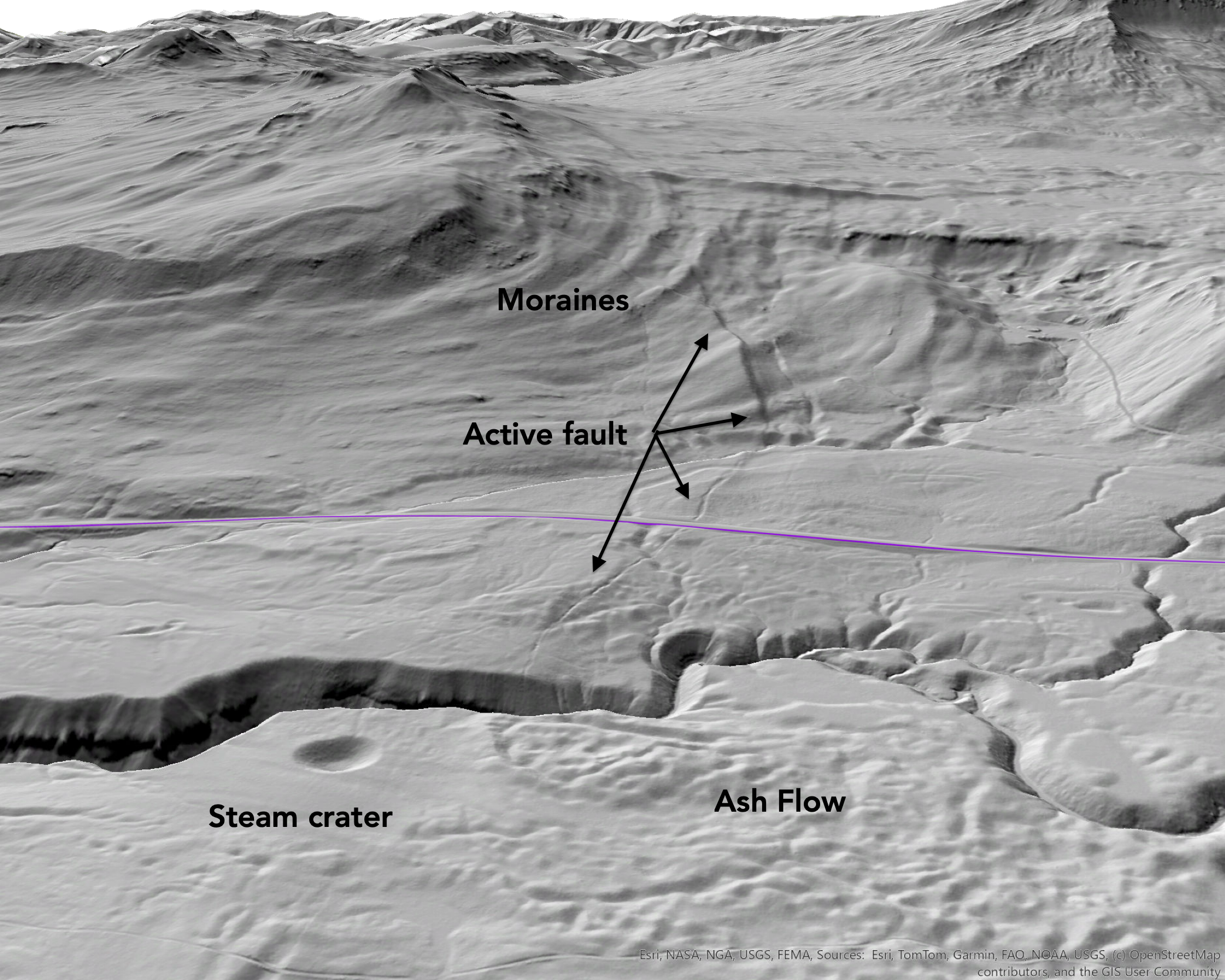
The active fault crossing the route at Mile 30.4 makes a clear scarp where it cuts across the 18,000-year-old moraines, and a subtle fissure where it crosses the young Mazama ash flow. It is not visible from the road. The steam crater is 430 feet wide and 200 feet deep.
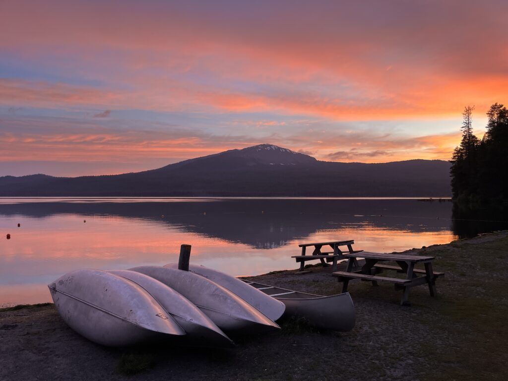
After the second rest stop the route leaves the Rogue River basin and descends into the basin holding Diamond Lake, which is in the headwaters of the North Umpqua River. The basin that holds Diamond Lake was carved out by a huge glacier fed by streams of ice from Mt Thielsen, Mt. Bailey and Mt. Mazama. The ice age had been over for 4000 years when Mazama erupted, so Diamond Lake was partially filled with ash flow. Diamond Lake is flanked by two volcanoes, Mt. Thielsen to the east is about 300,000 years old and Mt. Bailey is about 100,000 years old. Both have been heavily eroded by glaciers.
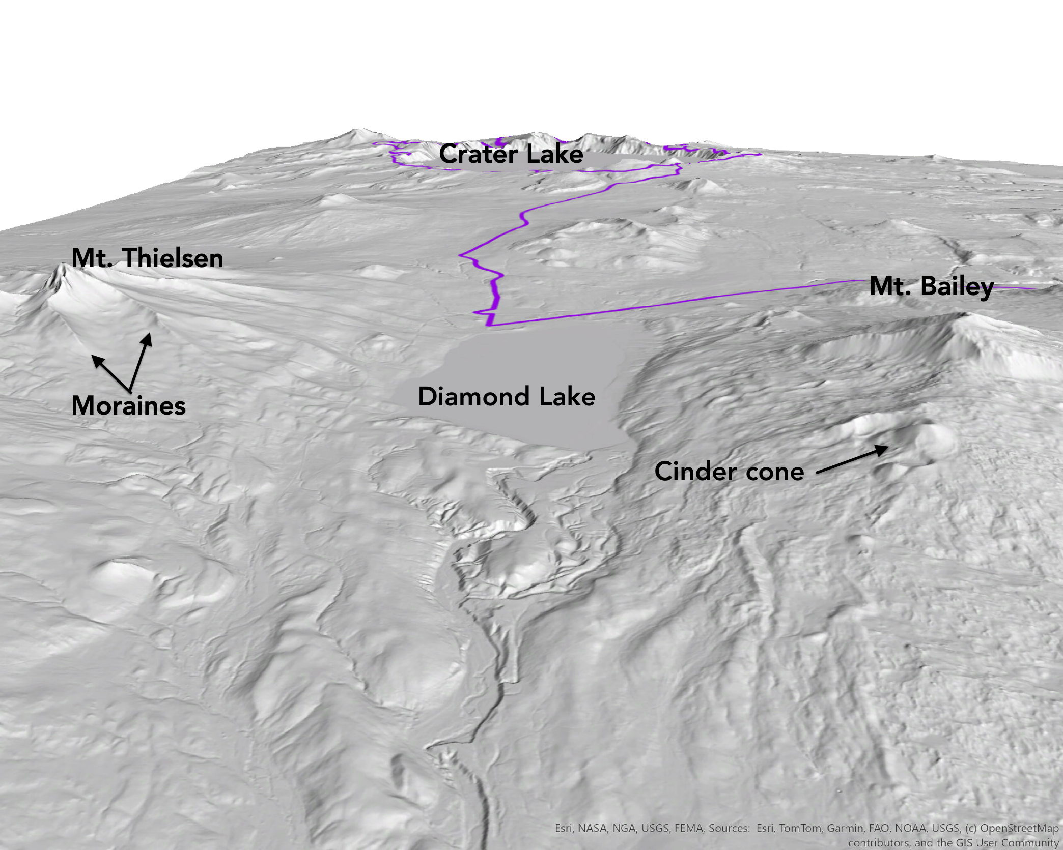
The valley that holds Diamond Lake was carved out by glaciers from the three mountains that surround it. There are well developed lateral moraines preserved on Mt. Thielsen. There is a well-preserved cinder cone on the flank of Mt. Bailey.
About Diamond Lake
In 2007 a Cycle Oregon Signature Grant helped restock Diamond Lake with trout. An invasive non-native fish species was ruining the lake’s ecosystem, and so the lake was intentionally poisoned to kill off the invaders. Afterward, an ambitious program set out to re-stock the renowned fishing lake with new trout, and Cycle Oregon contributed $50,000 toward the effort. Six months after stocking the lake, people were pulling trophy trout out of Diamond Lake. The restocking project successfully returned the trout population to Diamond Lake.
Wildstones
Off the bike, Ian applies his interest in Oregon geology through art and sculpture. Check out his work at Wildstones.art and follow him on Instagram to see what he’s up to in the studio, out in the field or in the saddle. Rock on, Ian!
For a downloadable PDF of Ian’s full report, click here.