Rally 2025 Day 1 / Prospect – Butte Falls
Geology Rocks! by Ian Madin
Ian Madin worked as a geologist with the Oregon Department of Geology and Mineral Industries for 32 years and has ridden with Cycle Oregon for over a decade now. Here, he gives us a look at the cool and sometimes hidden geology of the regions through which we ride. Look for him out on the route and back in camp at Rally ’25.
Mt. Mazama’s Eruption
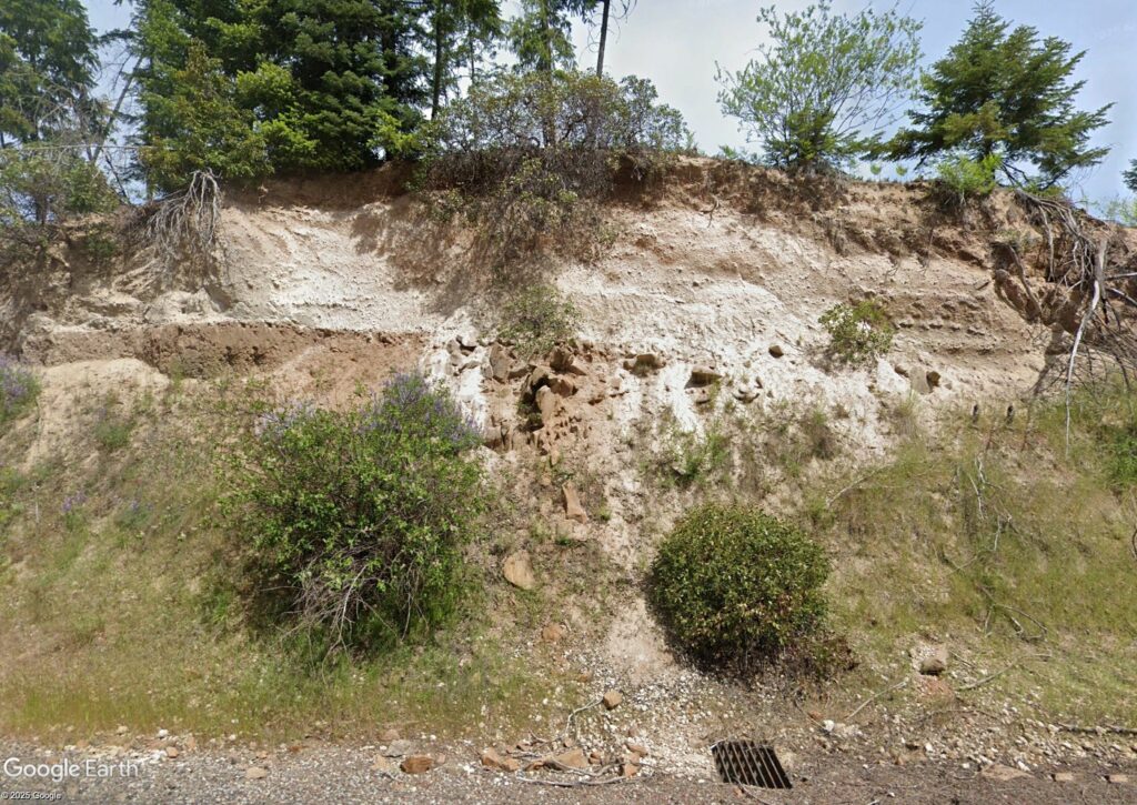
For most of the route on the first day, the geology is muted. There are few places where rocks are exposed along the route, and the forested terrain doesn’t show any distinctive geologic features. There is one very significant bit of geology in the first 5 miles, setting the stage for the next few days. About 3.3 miles out of Prospect, the route crosses the canyon of the West Fork of the Rogue River. After you cross the river and start to climb out of the canyon, you will see white volcanic ash and pumice in the roadcuts. This is fallout from the cataclysmic eruption that created Crater Lake.
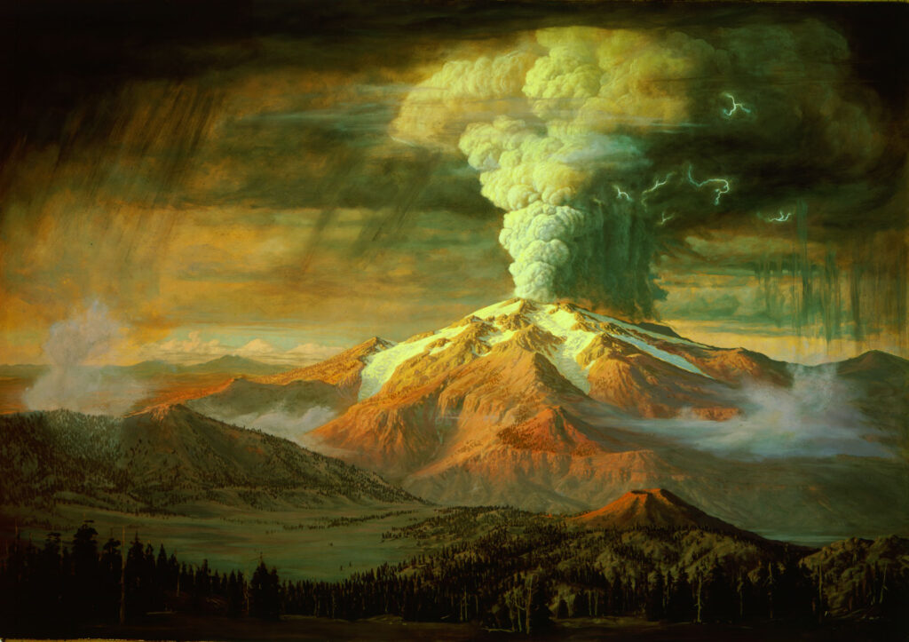
Paul Clark Rockwood / ca. 1939 / Oil on masonite
Crater Lake formed during an enormous eruption of Mt. Mazama, one of the many large volcanoes that make up the Cascade volcanic arc. Mt. Mazama had a long eruptive history, and before the eruption probably looked like Mt. Hood or Mt. Rainier; a snow-capped cone carved by deep glacial valleys. Simply projecting the lower slopes of the mountain upwards suggests that Mt. Mazama was 12,000 to 14,000 feet tall.
A reconstruction of the Mazama volcano before the Crater Lake eruption. All of the “ghost” mountain was blasted into the sky or collapsed into the empty magma chamber during the cataclysmic eruption 7,700 years ago.
About 7,700 years ago, the depths of Mt. Mazama were filled with huge amounts of hot silica-rich lava. As more magma filled the underground chamber, the pressure increased and started to slowly lift the top of the mountain, cracking it. At some point, a crack broke through to the surface during an earthquake, suddenly releasing the built-up pressure. Like a warm bottle of soda suddenly uncorked, the gas-rich magma expanded into red-hot foam. The explosive increase in volume caused the foaming magma to be ejected as cloud of expanding shattered pumice fragments and ash. The eruption decompressed deeper levels of magma, causing the foaming to accelerate and resulting in a massive column of hot gas, pumice and ash, which rose into the stratosphere. Larger fragments of pumice rained down for miles around the volcano, while ash was transported as much as 800 miles away.

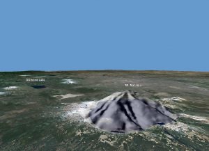
The image above is combined lidar and sonar and looks northwest across the stump of Mt. Mazama and Crater Lake, showing the shape of the land features as well as the lake floor. The faint bench around the crater marks the current lake shore and the purple line is the route. The bottom of the lake is very flat in many parts, but Merriam Cone and the Wizard Island volcano rise above it. The valleys in the foreground were filled with the ash flows and have flat wide floors. The steep sharp edged gullies have been eroded into the relatively soft fresh tuff in the last 7,700 years.
In the most intense part of the multi-day eruption, the ash and pumice were falling so thick around the vent that it coalesced into flowing rivers of red-hot fragments and gas; called a glowing avalanche or ash flow. These flows swept down the canyons leading from the mountains at highway speeds, obliterating everything in their path and filling the canyons. So much magma erupted that the top mountain collapsed into the empty magma chamber, leaving a hole nearly 4,000 feet deep. In the years that followed, rain and snow slowly filled the lake, and two small volcanos, Wizard Island and Merriam Cone, grew up from the floor.
Climbing out of the West Fork Rogue canyon, you can see thick layers of fine white ash studded with fragments of pumice. You may notice layers in the ash, formed as the eruption changed in intensity. When you reach the top of the short climb, there is an excellent view of the Mazama ash in the roadcut on the left at Mile 4.7. The shoulder is wide so take a break and have a closer look. This is a good place to pick up some pumice to take home. If you look at it closely you will see that it is like a sponge made of volcanic glass. The ash is simply pumice that has been shattered into bits.
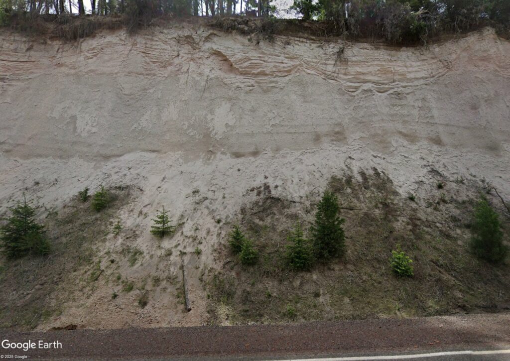
changes in the intensity of eruption and wind direction over the course of several days.
The next roadcut at Mile 4.9 past the top of the climb slices through an old volcanic vent. Red cinders and rubble surround a core of blocky lava. This vent was probably active 4-5 million years ago.
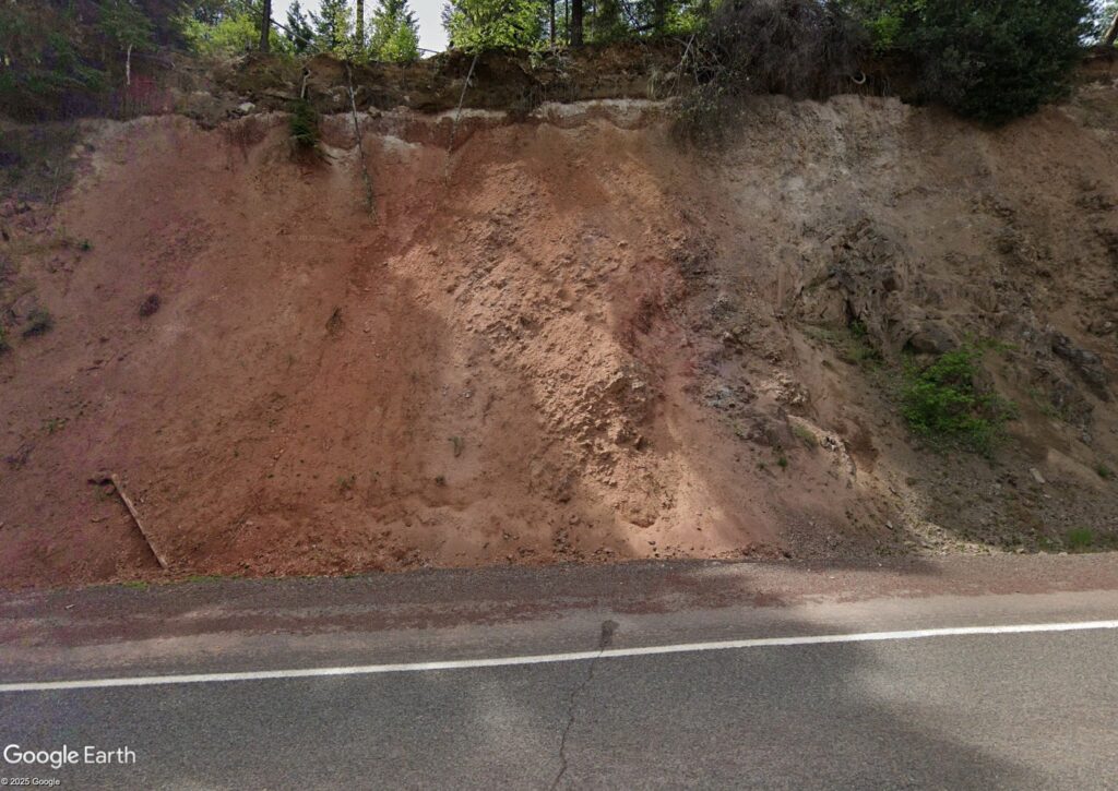
blocky lava that remained in the throat of the vent.
Directly across the road the red lava and rubble is buried beneath the Mazama ash giving us a glimpse of where the land surface was before the eruption.
For the remainder of the ride, on both the main route, long route and gravel you will be traveling through more lava flows from an earlier generation of Cascade volcanoes that were active from about 5 to 2 million years ago. You will see bits of lava in roadcuts, some will be broken into blocks or columns, others will break into thin plates.
From Prospect Camp
An easy 15-minute walk from camp is Prospect State Scenic Viewpoint & The Avenue of the Boulders where you’ll see first hand the force of volcanic eruptions and rushing water. These massive rocks were blasted from Mt. Mazama, over 20 miles away, when it erupted 7,700 years ago to form Crater Lake.
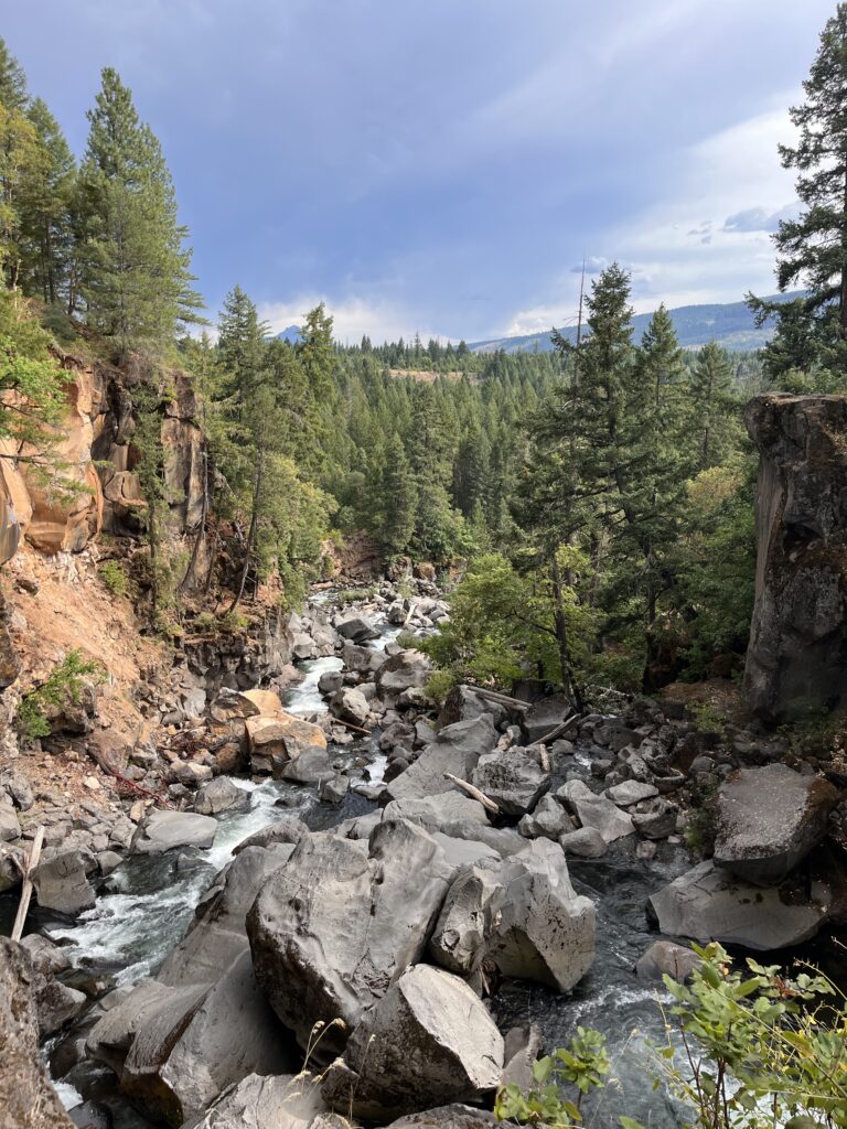
Above this point, the Rogue River runs flat before slipping under the Mill Creek Drive Bridge (once a covered bridge) and plunging into the Gorge. From the bridge, you see the Rogue’s spring torrents with Mt. McLoughlin beyond. A north-side trail offers a cliff-top view 100 feet above, while south-side trails lead down among the boulders.
Wildstones
Off the bike, Ian applies his interest in Oregon geology through art and sculpture. Check out his work at Wildstones.art and follow him on Instagram to see what he’s up to in the studio, out in the field or in the saddle. Rock on, Ian!
For a downloadable PDF of Ian’s full report, click here.