Geology Rocks! by Ian Madin
Ian Madin worked as a geologist with the Oregon Department of Geology and Mineral Industries for 32 years. In his spare time now he enjoys riding with Cycle Oregon and sharing stories about the incredibly cool geology of Oregon. Here, he gives us a look at the cool and sometimes hidden geology of the regions through which we ride.
Prime Time in the Canyons: The Timeless Grit of Tygh Valley
When we talk about “deep time” in Tygh Valley, we aren’t just talking about the history of our 2026 event or the few times we’ve spent at the Wasco County Fairgrounds. We are talking about 16 million years of catastrophic floods, volcanic upheaval, and the slow, steady work of the White River.
The geology of this region doesn’t change—at least not on a human timeline—but the way we experience it does. Whether you are a Tygh Valley veteran or joining us for your very first GRAVEL, here is your guide to the landscape of the “Long View.”
Vertical Time Travel
As you roll out from basecamp and begin your climb, you aren’t just gaining elevation; you are traveling forward in geologic time.
The Foundation (16 Million Years Ago):
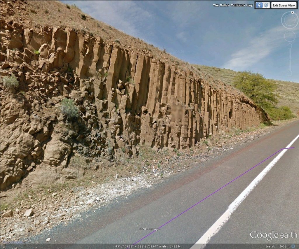
Deep in the canyons—like the descent toward Maupin or the base of White River Falls—you are riding over the Columbia River Basalts. These are the remnants of one of the greatest flood basalt events on Earth. Imagine lava flows 100 feet deep, traveling all the way from the Idaho border to the Pacific Ocean. When you see those hexagonal columns in the canyon walls, you’re looking at liquid fire that shrank as it cooled.
The Apron (6 Million Years Ago):
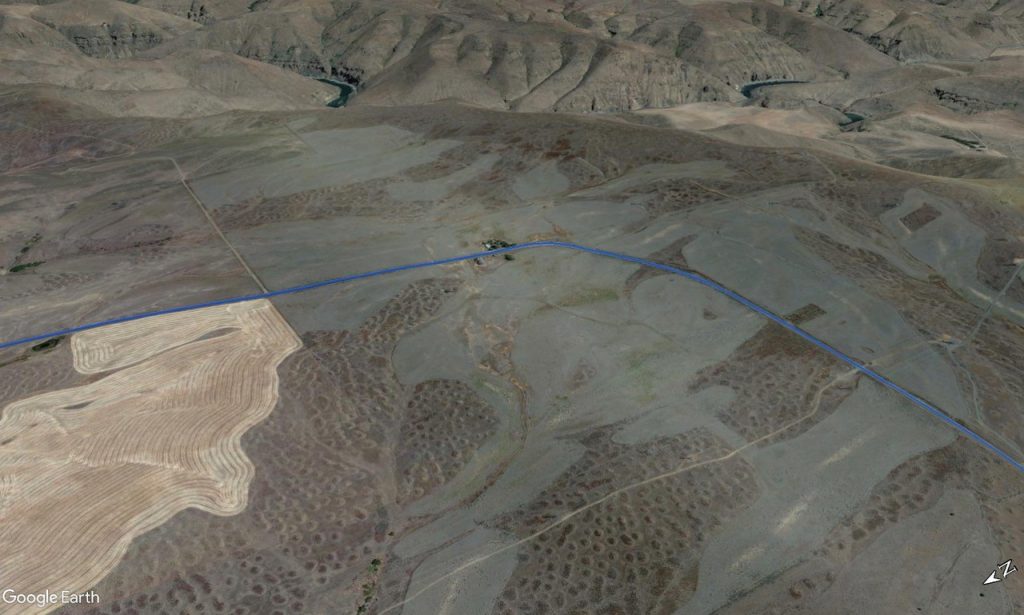
Once you crest the “Tygh Ridge Fold” and reach the high plateaus of Juniper Flat, you’ve moved ahead 10 million years. You’re now riding on the “Dalles Formation,” a massive debris apron shed by the ancestors of Mt. Hood. This layer is made of volcanic sand and rounded river rocks—the very “grit” that gives our gravel its unique character.
Things to Look For:
While you’re enjoying the views on our 2026 routes, keep an eye out for these geologic “Easter Eggs”:
- The Mima Mounds: On the plateau stretches (especially on Saturday’s long route), look for the small, repetitive “goosebumps” in the fields. Some geologists say they were formed by seismic activity; others swear by the “Gopher Theory,” suggesting generations of rodents built them over centuries. We’ll let you decide which makes for a better mid-ride story.
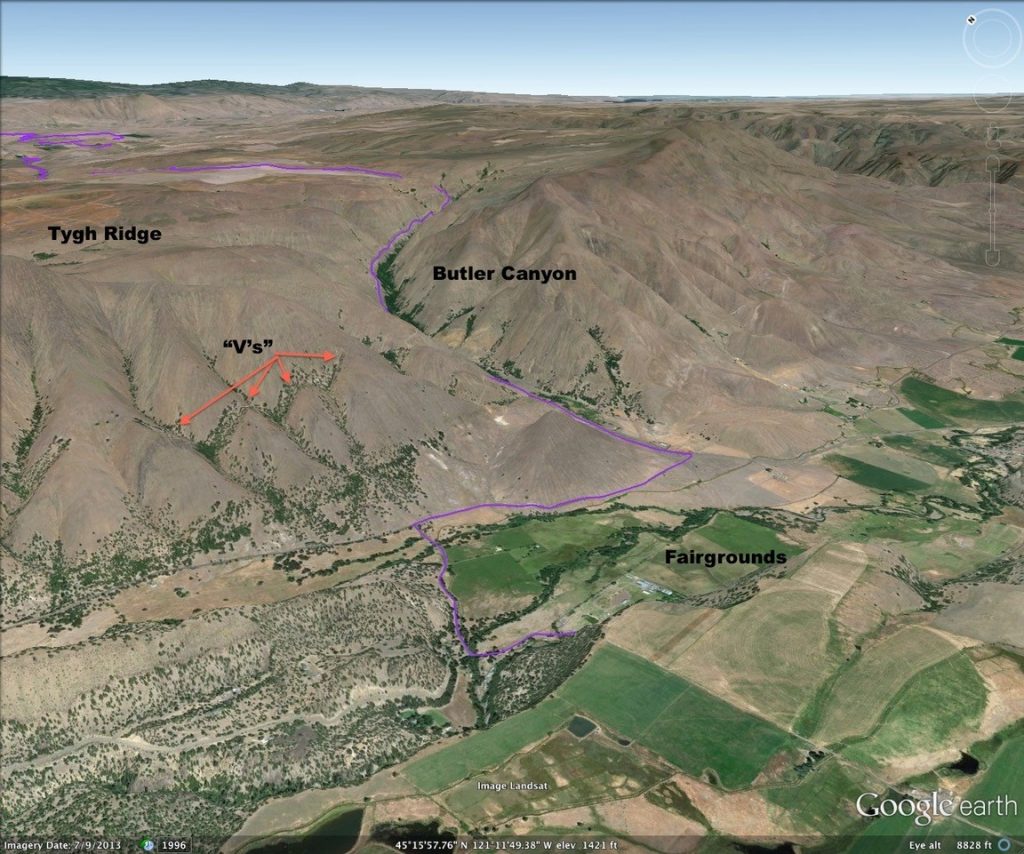
- The Inverted V’s: Look north from Fairgrounds Road toward Tygh Ridge. You can see the literal “folds” in the Earth where the landscape was squeezed like a rug, pushing ancient layers of rock into the sky.
- The White River Migration: Near the falls, notice how the river has “migrated” upstream. The dramatic drop-off wasn’t always there; it’s a result of a massive landslide that rerouted the river, creating the spectacular view we enjoy from camp today.

Why the Grit Matters
We often talk about the “joy” of the ride, and in Tygh Valley, that joy is earned on the surface. The gravel here is a mix of angular basalt and rounded volcanic rubble. It’s technical, it’s vibrant, and it’s a direct link to the landscape’s history.
But more than the rocks, it’s about the place. This rugged terrain has shaped the resilient communities of Wasco County for generations. By riding here, we aren’t just passing through; we are connecting with the history of the land and supporting the community-first programs that keep this region thriving.
So, when the climbing gets tough on Tygh Ridge, just remember: you’re only traveling through 16 million years of history. Enjoy the view—you’ve earned it.
The Anatomy of the Grind: A Gravel Deep Dive
Let’s talk about the surface beneath your tires. You’ve wobbled on it, skittered across it, and likely cursed it once or twice—but what is gravel, really?
Aside from water, gravel is our most used natural resource. It literally underpins modern society. In 2018 alone, Oregon produced nearly 40 million tons of the stuff—about 10 tons per Oregonian. That’s enough to fill 2.4 million dump trucks. What did you do with your 10 tons this year?
The Geologist’s Ruler
To a geologist, “gravel” is any aggregation of rock fragments larger than 2 mm. It’s a game of scale:
- Granules: 2 mm – 4 mm
- Pebbles: 4 mm – 64 mm (the “sweet spot” for riding)
- Cobbles: 64 mm – 256 mm
- Boulders: Anything larger than 10 inches
How that gravel behaves depends on sorting (the variety of sizes in a mix) and rounding. If the fragments have sharp edges, they are angular; if they’re smooth, they’re rounded.
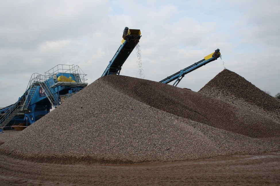
Crushed vs. Natural
Gravel is either excavated from ancient riverbeds or produced by crushing hard rock like basalt.
- Crushed Rock: Always angular. Because the sharp edges interlock, it can be compacted into a dense, stable layer—perfect for roads.
- River Gravel: Naturally rounded by centuries of tumbling. It stays loose and doesn’t compact well, making it terrible for road surfaces but excellent for drainage.
In Oregon, our “black gold” is basalt. This dense, volcanic rock is found across the state, which is vital because gravel is heavy—the biggest cost in road building is simply moving it.
The Perfect Road
Building a high-quality gravel road is an art form. It’s not just dumping rocks; it’s engineering.
- Preparation: Surface soil is removed, and the subsoil is compacted.
- The Base: A layer of large gravel is laid down for drainage and structural support.
- The Surface: A specific blend of angular pebble gravel and finer “fines” is applied to create a smooth, cohesive crust.
- The Crown: The center of the road must be higher than the edges, allowing water to shed rather than pool.
When the chemistry of size, shape, and compaction is just right, a gravel road offers a smooth, fast ride for cars and bicycles alike. Over time, speed creates those dreaded washboards, requiring regular grading and fresh applications of “the grit.”
So, the next time you’re climbing a ridge in Tygh Valley, take a second to look down. You aren’t just riding on dirt—you’re riding on a carefully engineered Oregon resource.
Let’s ride!